
The Wolds Way – Great Yorkshire Walks
Introduction to The Wolds Way
We are lucky enough in Yorkshire to have some of the best and varied countryside in t’land to explore, from the high hills of the Dales and moors to the fertile plains of the east, which run down to the rugged North Sea coastline. Over the years a series of long walks have been established across the Ridings, which seek to encapsulate the very best of both natural and man-made Yorkshire. While it may be wise to tackle these routes in stages, our guide tells you where each walks go and what to look out for along the way.
This walk begins and ends near water, stretching 79 miles from the banks of the Humber Estuary to Filey Brigg on the East coast. It was opened in 1982 and winds its way through the rolling hills and fields of East Yorkshire. The walk begins at Hessle Foreshore, with expansive views of the Humber Bridge and estuary. The route is dotted with historic market towns, such as Market Weighton and quaint rural villages, such as Millington; the ideal place to stop for a bite to eat. You can also explore the abandoned village of Wharram Percy, enjoy the serenity of Londesbrough Park and admire the coastal beauty of Filey along the way.
The walk can be divided into five sections, which is designed for a full day’s walk and overnight stays along the way. If this is not for you, then it is perfectly feasible to walk a few miles each way and find a place to park the car if necessary for you to continue on another day. Here goes..
Stage 1: Hessle to South Cave (13 miles)

Hessle Foreshore: The starting point. Stretching out across the estuary is The Humber Bridge, which was opened in 1981 and was the then largest single span suspension bridge in the world. While this may not be the case anymore it is still a magnificent site and excellent landmark to start your walk on the Wolds Way. This first stretch takes you through North Ferriby and Welton. The former lies on the shores of the Humber and is where the oldest boats in Europe were discovered in 1931, preserved in the mud dating back to The Bronze Age.
The picturesque village of Welton has a pub called The Green Dragon, which is where Dick Turpin was arrested. His warrant is still on display on the walls. Onwards, the village of Brantingham is also well worth stopping to have a look at, especially its sizable duck pond and war memorial, which was made from reclaimed material from the demolished Hull Town Hall in 1922. Through the woods lies the village of South Cave and here is where you can get public transport back to Hull or Hessle if required, or park your car for next time.
Stage 2: South Cave to Market Weighton (12 miles)
On leaving South Cave look out for the wonderful views of The Humber estuary spread out in front of you. As you head North East towards North Newbald you encounter the dry valleys of Swindale and the route of a now disused Hull to Barnsley railway. North Newbald has two pubs to choose from and a historic Norman Church to discover. After this village you head towards Market Weighton. On the way you will walk over some of the oldest turf in Yorkshire, past the lost village of Arras, where several Iron age barriers were discovered in 1815. It is also worth looking up, as the view across Yorkshire is magnificent from these hills on a clear day.

Market Weighton has a wealth of pubs and shops to choose from and somewhere to stay if required, such as the 17th Century Londesbrough Arms Hotel. The town is also home to the Yorkshire Giant, William Bradley. His statue and heritage trail can be found in the town centre.
N.B Passing through Market Weighton is optional, and walkers can instead pass through Goodmanham to Londesborough Park instead if they wish. This is signposted along the route.
Stage 3: Market Weighton to Fridaythorpe (17 miles)
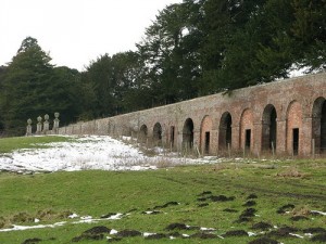
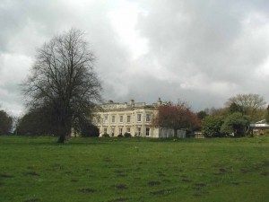
Moving on from here we head up into the heart of the Yorkshire Wolds. Two miles north lies Londesborough Hall and Park. This estate once housed an impressive Elizabethan manor house, now demolished, but the remains of it can still be seen. The Kings Steps, which were deer shelters are a striking feature of the park and is all that’s left of the original hall. The estate used to belong to the railway king, George Hudson and the foundations of a private railway line and station can still be seen in the undergrowth near the village. Red Kites, a recent re-introduction to Yorkshire, can be seen here in their full glory.
Walking between Londesborough and Nunburnholme it can feel like you are on top of the world! Looking down at the view beneath, you can on a clear day see York Minster, the three power stations of Ferrybridge, Drax and Eggborough, plus the shadowy shapes of the Pennine hills in the distance.
Past this village you head north to a very tranquil place called Kilnwick Percy. This is home to the Madhayamaka Kadampa Buddhist Meditation Centre, a place for world peace and reflection based at Kilnwick Percy Hall, which dates back to the 16th Century.
The Wolds Way path then takes you to the quintessential Wolds Village of Millington, where its woodland, pasture and views make for a lovely part of the walk. If the weather is clear you can see the Humber bridge, Flamborough Head lighthouse and even Lincoln Cathedral.
Two more opportunities for a well earned rest and food present themselves in both Huggate, home of one of the deepest wells in England and Fridaythorpe, via the beautiful Horse Dale and Holm Dale.
Near these beauty spots is a bench, which is part of the WANDER artwork project. This is a series of artistic seats inscripted with poetry from John Wedgewood Clarke, who used the East Yorkshire scenery as inspiration for his work.
In Fridaythorpe there is another WANDER artwork, a red bus shelter which marks the halfway point of the Wolds Way.
Stage 4: Fridaythorpe to Sherburn (22.5 miles)
The Wolds Way heads out of Fridaythorpe towards the charming village of Thixendale. This is home to wildlife artist, Robert Fuller, who has a gallery in the village; a place where birds and animals are all around. There are said to be sixteen dales which lead to Thixendale, count them as you walk.

Next on the journey is the abandoned village of Wharram Percy. This settlement was abandoned in the 15th Century and all that remains are the eerie ruins of St Martin’s Church.
Further along the path you arrive at the top of Settringham Beacon, which gives the first teasing glimpse of the North Yorkshire Moors in the distance. The Howardian Hills can also be seen to the West and the Cleveland hills to the North and in an Easterly direction; the Vale of Pickering.
After passing the village of Wintringham you come eventually to Sherburn. A good landmark between Wintringham and Sherburn is another WANDER artwork, which celebrates the rich archaeology in the area. Sherburn is located on the A64 Scarborough to York Road. There are good public transport links to places such Leeds, Malton, York, Scarborough and Filey if required.
Stage 5: Sherburn to Filey Brigg (17 miles)
The last leg of the Wolds Way takes in the Southern edge of the North Yorkshire moors to the coast. The fields between Sherburn and Ganton were the site of small Iron Age settlements and there are many earthworks to look out for in this part of the route. The lands here were given to Bridlington Priory and the woodland was cleared by monks for grazing their sheep. Most of the walk is at height and is sandwiched between the Yorkshire Wolds on one side and the Moors on the other.

Names like Binnington Brow, Stocking Dale and Camp Dale roll beautifully off the tongue and the village of Muston is within reach. A stile and a ginnel takes you into the town of Filey and your journey is nearly at an end. Once you encounter the sculpture marked with the Wolds Way acorn, high up on the cliffs at Filey you are at the end of the route, which started off 79 miles away in Hessle. This point officially marks the beginning of the Cleveland Way, but that’s another story…